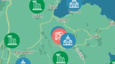
VRBNIK'S HIKING ROUND TRIP
Path length: 24 km
time of walking: 8 hours
very demanding path
VRBNIK – POD ČERENEC – POTOVOŠĆE BAY – SRŠĆICA BAY – VINCA – TRNOVICA - KOTA 387 – NAVRHVALA – VALNIŠĆE – POD MALI HLAM – MALI HLAM (446 m) – HLAM (425 m) – ČIČIŠĆE – LUG – VRBNIK
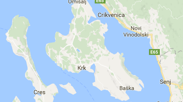
From the centre of Vrbnik along Grohot Street (the remains of the St. Mavro - Sv. Mavar small 11th century church) you reach the Pod Čerenec crossroads, where you turn left. A paved road with a beautiful view of the Vinodol Channel takes you to Potovšće Bay (where you can take a swim). At the very end of the beach turn left, and the path will lead you above St. George Bay (the remains of the small church of St. George - Sv. Juraj) in the direction of the Sršćica Bay (where you can take a swim) and to the area known as Vinca (the remains of the 15th century church of St. Nicholas - Sv. Nikola, ornithological reserve). There are numerous caves along the coastal area, which, for centuries, served as shelters for fishermen and boats, shelters for equipment and food as well as for pirates, fugitives and thieves, especially during the war periods. The path then climbs through the rocky area across the Trnovica (water hole) and enters a long rocky canyon until it reaches the Kota 387. Across the wide plateaus of Navrhvala, Valnišće and Podole where, during the summer, many flocks of sheep pasture, we arrive under the M. Hlam, at the crossroads leading to Vrbnik, Žanac and Mali Hlam, the highest peak of the area of the Municipality of Vrbnik. By the steep road we reach M. Hlam (446 m) where a beautiful view is provided not only of the other parts of the island of Krk but over Velebit, Risnjak, Učka, island of Cres, Plavnik all the way to Prvić, St. Gregory - Sv. Grgur and the peaks of the island of Rab. The easier part of the path leads through Hlam (425 m) and Čičišće to the Lug (Vrbnik’s field) and comes out at the crossroads close to the small church of St. Nedija - Sv. Nedija which dates back to 1445. The road takes us to the right, from the Pod Čerenec crossroad and then left through Grohot Street where we descend to the centre of Vrbnik. Just before Čičišće, there is a wide trail leading all the way to Tohoraj and to the heart of Vrbnik. The trail affords unforgettable views of Vrbnik and Vrbnik field – Vrbničko polje.
KORISNE INFORMACIJE
Adresar korisnih informacija možete pogledati ovdje
KAKO DO NAS?
Osobnim vozilom, autobusom, avionom ...